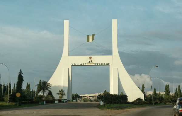
THE CAPITAL CITY
Nigeria has had 3 federal Capitals since its creation in 1914.
Calabar was the capital till 1906 (controversial).
Lagos was the capital from 1906 to 1976.
Abuja has been the Federal Capital from December 12 1991 till date.
INTRODUCING ABUJA
Abuja, the present Federal Capital Territory of Nigeria is located in the centre of the country. It has an Area size of 713km2, which is two and half times the size of Lagos, the former Federal Capital.
The name Abuja originally belonged the south-western part of the ancient Habe(Hausa) kingdom of Zazzau(Zaria). In the early 1800s Zaria fell to Fulani invaders and a man named Muhammed Makau along with his brothers, Abubakar and Kwaka, and some of his followers fled to the south where he became King. In 1825 Abubakar became King after his brother. Abubakar was popularly called Abu Ja, Abu- short for Abubakar and Ja- meaning fair/light skinned(directly translated as Red in Hausa Language). However, some believed that Ja was the short for Ishaku Jatau, his father’s name. The land of Abuja was named after King Abubakar; it later became a major commercial centre. In 1902, Abuja was occupied by the British who reorganized the kingdoms (in Northern Nigeria and the middle belt) and called them Emirates (meaning Kingdom in Arabic).
In 1975 while Lagos was still the Federal Capital, the search for a new Federal Capital began due to;
- The population boom in Lagos; and
- Political and ethnic divisions
The criteria for selecting a new site for the Federal Capital were:
- Central Location,
- Land availability,
- Climate,
- Water supply,
- Multi-access possibilities,
- Security,
- Resources,
- Drainage,
- Good soil,
- Physical planning convenience,
- Health, and
- Ethnic record.
The area that was finally chosen was gotten from 3 states:
- Four districts from the old Abuja(which was in the present day Niger State;) this made up to 80% of the land.
- Plateau State(present day Nassarawa state) contributed 16% which forms the south-east territory.
- Kwara state (present day Kogi State) contributed the remaining 4% which forms the south-west territory.
After the area was chosen, the federal government sought for a name for the Federal Capital and the name Abuja was suggested. At the time Abuja was the name of the Emirate which had given up most of its land for the Federal Capital Territory, so the Emirate Council was reluctant to also give up the name of their Emirate. Eventually the council agreed to give up the name in the hopes that the name Abuja would become famous throughout the world. The original town of Abuja was then renamed Suleja; Sule-gotten from Altai Suleiman Bara, the Emir of Abuja at the time and Ja– retained from the last syllable of Abuja.
On February 4, 1976, a decree was signed establishing the Federal Capital Territory of Abuja and setting up the Federal Capital Development Authority(FCDA), the organization charged with the task of developing the new Capital. Physically located in the centre of the country and viewed as neutral both ethnically and religiously, it is where culture and religion meet. The FCT has borders on the north with Kaduna State, on the South-east with Nassarawa State, on the South-west with Kogi State and on the West with Niger State.
In the late 1970s the construction of a new Federal Capital in the new city of Abuja began, but due to economic and political instability, the initial stages of the city were not complete until the late 1980s.
Replacing Lagos, Abuja officially became Nigeria’s capital on December 12, 1991.
ADMINISTRATION
The Minister of the Federal Capital Territory is the political head of the City and is appointed by the President. There are six Area Councils in the Federal Capital Territory, (each subdivided into wards headed by Local Councils);
- Abaji Area Council
- Abuja Municipal Area Council
- Bwari Area Council
- Gwagwalada Area Council
- Kuje Area Council
- Kwali Area Council
INDIGENOUS TRIBES
- Bassa
- Gade
- Ganagana
- Gbagyi(Gwari)
- Gwandara
- Koro etc.
ASO ROCK
Aso rock is a monolith rock in Abuja. The presidential villa is located close to the rock and so the name Aso Rock is sometimes used to refer to the physical structure of the Presidential villa. The name Aso Rock also represents political power.
In the native Gbagyi language the word Aso means ‘Victory’. According to traditional history, the original inhabitants of the region lived at the base of the rock for centuries without being conquered. The rock was a refuge as well as a mystical source of strength. Asokoro, the name of one of the local areas in Abuja therefore means ‘People of Victory’.
THREE ARMS ZONE(TAZ)
This is an area in Abuja that accommodates the Presidential Villa, the National Assembly and the Supreme Court within a short distance of each other surrounded by a ring road. The name Three Arms Zone was given because the highest points of the three arms of government are located there; the Presidential Villa representing the Executive arm of government, the National Assembly representing the Legislative arm of government and the Supreme Court representing the Judiciary arm of government.
NATURAL MINERALS: Cassiterite, Clay, Dolomite, Gold, Lead/Zinc, Marble and Tantalite.
Abuja is the centre of unity, centre of power and the home of the Nigerian Elite.

